Bushwhack to Rusk Mountain
No trail? No problem. Using only a compass and GPS, navigate to the summit of Rusk Mountain at 3,680' in the Catskills region.
Parking: 42.184158,-74.272180 Spruceton Rd, West Kill, NY
Miles: 3.5-4
Hours: 2.5
Gear:
Starting from the parking lot and the blue Spruceton trail I signed in at the register. An easy half mile walk on the trail and crossing a bridge would bring me to the base of my climb (just before the hairpin right turn). Checking my GPS, I crossed over one creek and began the rise with another creek just to my left. I would follow this water source most of the way up until it became sparse and rocky.
On my way up the slope, the light dusting of snow began to thicken to about 2 inches. The terrain was steep and slippery in spots because I could not see what I was stepping on. Snow on top of leaves on top of rocks made each step unsure and furthered the importance of my trekking poles.
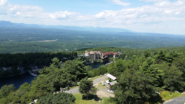
I couldn't help but stop and admire the scenery each time I consulted my GPS. Had this been a different season I probably would not have been able to see the Devil's Path and West Kill Mountain in the distance. All around me there was nary a sign of civilization, though I was not far from it.
As I reached an elevation of 3,000' there was a soft brow in the terrain. I paused here to survey my final 600 foot incline. I could see and smell the pine that has become so recognizable to me at these elevations. A winter wonderland lay ahead in the midst of autumn. At around 3,500' I checked my GPS and found myself among the clouds.
Reviewing trip reports from other hikers before I set out I recalled that there were herd paths atop the mountain's ridge, stretching west to east from Rusk to East Rusk. Despite the snowfall they were easy to spot. Noticing the terrain beginning to fall, I turned west and found a depression in the ground. Conferring with my GPS I moved with the herd path, and found the summit register about a hundred feet ahead! My first real venture off trail with GPS only had concluded as I reached the peak of Rusk Mountain. An indescribable feeling rushed over me. Reaching into the canister and retrieving the log, I delightfully signed my name next to those that came before me. Retracing my steps, literally, I descended the mountain in just 45 minutes (it took about an hour 25 minutes from the parking lot to the summit). On to the next one!
 |
| West Kill Mountain and the Devil's Path, as seen from the slopes of Rusk Mountain |
Miles: 3.5-4
Hours: 2.5
Gear:
- daypack
- 1.5L of water
- snacks
- first aid
- tape
- knife
- water filter
- compass
- gaiters
- GPS location services from smartphone
- trekking poles
- windbreaker and layers for warmth
- map - New York New Jersey Trail Conference #141
- hiking boots
- NO COTTON - Why no cotton? Cotton is a thicker material and isn't as breathable as synthetic materials. Once it's wet, it becomes heavier and takes longer to dry.
Starting from the parking lot and the blue Spruceton trail I signed in at the register. An easy half mile walk on the trail and crossing a bridge would bring me to the base of my climb (just before the hairpin right turn). Checking my GPS, I crossed over one creek and began the rise with another creek just to my left. I would follow this water source most of the way up until it became sparse and rocky.
 |
| This is the spot where I leave the trail and begin the bushwhack to the left |
I couldn't help but stop and admire the scenery each time I consulted my GPS. Had this been a different season I probably would not have been able to see the Devil's Path and West Kill Mountain in the distance. All around me there was nary a sign of civilization, though I was not far from it.
As I reached an elevation of 3,000' there was a soft brow in the terrain. I paused here to survey my final 600 foot incline. I could see and smell the pine that has become so recognizable to me at these elevations. A winter wonderland lay ahead in the midst of autumn. At around 3,500' I checked my GPS and found myself among the clouds.
Reviewing trip reports from other hikers before I set out I recalled that there were herd paths atop the mountain's ridge, stretching west to east from Rusk to East Rusk. Despite the snowfall they were easy to spot. Noticing the terrain beginning to fall, I turned west and found a depression in the ground. Conferring with my GPS I moved with the herd path, and found the summit register about a hundred feet ahead! My first real venture off trail with GPS only had concluded as I reached the peak of Rusk Mountain. An indescribable feeling rushed over me. Reaching into the canister and retrieving the log, I delightfully signed my name next to those that came before me. Retracing my steps, literally, I descended the mountain in just 45 minutes (it took about an hour 25 minutes from the parking lot to the summit). On to the next one!


I climbed Rusk two weeks ago with my friend Ariel. We found a very obvious herd path that started just before the hairpin turn and led right to the summit. On the way down, we lost the herd path and bushwhacked instead.
ReplyDelete