The Escarpment Trail
Arguably the most picturesque trail in the Catskills, this 23.9 mile path follows the northeastern border of the Catskill Mountains. It can be hiked over 2 or 3 days. I traversed this trail in two.


Parking: Start Point (where I was dropped off) Schutt Road Trailhead Parking, Palenville, NY; End point (where I parked) Elm Ridge Forest Parking, Route 23, Windham, NY
Distance: 23.9 miles (without detours for water)
Time: 2 days, 1 night


Gear:
Distance: 23.9 miles (without detours for water)
Time: 2 days, 1 night


Gear:
- overnight pack
- 2L of water
- Meals and snacks for 2 days
- Pocket Rocket stove, Pinnacle Soloist cook-set, utensils
- First aid, tape, multi-tool, headlamp, 550 cord, carabiner
- Sawyer Squeeze Mini water filter and 16 oz. 'dirty' bag
- Casio Patherfinder Watch with compass, altimeter and barometer
- Counter Attack Bear Spray
- Smartphone for GPS and camera
- Tarptent Protrail with ground sheet
- Kelty 40° Sleeping Bag
- Clothes (aside from wearing) - 1 pair socks, 2 shirts, underwear, fleece
- Firestarters, lighter
- Trekking poles
- Map - New York New Jersey Trail Conference #142
- Hiking boots
- NO COTTON - Why no cotton? Cotton is a thicker material and isn't as breathable as synthetic materials. Once it's wet, it becomes heavier and takes longer to dry.
The escarpment trail is one of the longest and most rugged trails in the Catskills. It stretches 23+ miles from North-South Lake in the south to Route 23 in Windham to the north. There are 2 Catskill 3500 peaks along the trail (Blackhead and Windham). Views are plentiful and steep elevation gain & loss are the norm.
Since this trek is a 'thru-hike', I would need to leave my car at the end and catch a ride to the start. I was lucky enough to find a shuttle from a local guy named Greg. He was hiking in the area that day as well and so we met at the parking area on Route 23. We are both members of a Facebook group called Catskills Trail Conditions. It is a great group of people who provide trail info and share their photos and experiences hiking in a region in which we all have a passion for.
Getting the early start I did would prove to be crucial. Greg dropped me off at the Scutt Rd. parking lot in the North-South Lake area around 7:30 a.m.. From here the trail heads south-southwest then turns east as it climbs and circles around North-South Lake. The landscapes seen from these rocky view points were inspiration for 19th century artists such as Thomas Cole and Frederick Church. The mountains are what inspired Cole to found the Hudson River School for landscape painters.


Having seen the beautiful valley's and mountain tops from the trail it's easy to see how one could be artistically inspired. It is also easy to see how one could dream of a hotel sitting atop these hills overlooking the Hudson Valley. Many hospitality businesses thrived in the Catskills in the 19th century, but none had the star power as the Catskill Mountain House.
Opening in 1824 in Palenville, NY the Catskill Mountain House sat at 2,250' above sea level. It was visited by the elite and wealthy of the day along with 3 U.S. presidents: Ulysses Grant, Chester A. Arthur and Theodore Roosevelt. It's heyday was from 1850-1900. It's decline would run its course before the U.S. entered into WWII. The last season the hotel was open was 1941. The land the hotel occupied was purchased by NY State in 1962. Although it's historic value was rich and recognized, the hotel was burned down by the state on January 25, 1963. In accordance with Forest Preserve management policy (and strict interpretation of the law at the time), no structure could be built upon land that was decreed by the government to be "forever wild". All that remains today are the beautiful views, a plaque and information register.


 |
| Catskill Mountain House c.1892
After the old hotel site the trail rises again to North Point, follows its ridge-line north to Stoppel Point and Milt's Lookout before losing elevation to the Dutcher's Notch.
Stoppel Point is the site of a small plane crash, one of several in the region. The pilot of this plane was inexperienced and without his license at the time of the crash. I have been to 2 other crash sites and it feels odd to take photos as if its an attraction. There is a solemn and creepy feeling standing in front of such wreckage in which someone lost their life. I reviewed the site with respect to the dead and refrained from taking pictures. I sat for a moment of silence and then carried on.
Milt's Lookout was a nice place to break before my last push to camp. I bumped into a few other hiker's there along with a small snake who was soaking up the sun.
      
Running low on water it was time to refill before I made camp for the night. I descended the mountain to a trail intersection at Dutcher Notch. Turning right on the yellow trail I hiked about one half mile to a spring right beside on the trail. I sat for a few minutes as I hydrated and topped off my water supply.
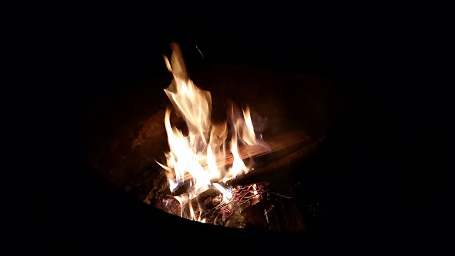
Back on the blue blazed Escarpment trail, I would need to gain some elevation before a large brow in the mountain leveled the ground. About a quarter mile after reaching this incline-reprieve there is a path leading to a primitive camp with a view (off to the left). I quickly pitched my tent & crawled in for a nap before dinner. Laying there still with my eyes closed I was out of energy. I mean totally done. I had never been so drained of will upon settling at camp. I didn't even want to eat I was so tired, but I knew I had to. Anxiously and faintly I cooked dinner and ate under overcast skies and cool temperatures. No sooner had I finished my food I was passed out in my tent. 8:00. Nite nite.
   
This is my view from camp. Some of the mountains in the distance are part of the Devil's Path
Feeling slightly renewed, I woke to the same grey skies and crisp air I fell asleep to. An early start was necessary, for I had a long day ahead. I ate some oatmeal & a granola bar and then I was on my way.
Leaving the primitive camp and getting back on the trail, I had to rise with the terrain until I came upon a lookout at around 3,400'. I paused here to admire the view and pressed on. Elevation was then lost (around 100') and the trail eased for a mile or so. What lay ahead was my quarry: Blackhead Mountain. The first of two 3500 peaks on the escarpment, Blackhead is the 5th tallest mountain in the Catskills at 3,940 feet above sea level. I have been to it's summit twice before - once in winter (click here to read more) and once in fall (click here to read more).
Soft paths gave way to steep inclines as the mountain began to peak. After a 500+ foot push the unimpressive summit presented itself.
    
The summit is a junction where the yellow Blackhead Mountain trail terminates. It connects the Black Dome Range trail to the summit of Blackhead.
   A quick snack and a breather was all I took from Blackhead Mountain this day. With over 10 miles to go, I needed to find and filter some water. The Batavia Kill lean-to serves as a sort of base camp for hikers and backpackers. It is located off the yellow Batavia Kill trail about a mile and a quarter down from the summit on its north side. It is ideally situated alongside a fresh water source. Meandering through several groups of interspersed campers I found a spot with a good flow from which to gather life, a.k.a. water a.k.a H2O. I drank my fill then topped of my reservoir with enough water to last the remainder of the hike.  Back on the trail the next several miles would be a relatively easy up & down walk through the woods. There were some nice views along the way from Acra Point to Burnt Knob, two peaks at around 3100' (separated by about 1.5 miles).             Windham Mountain is the next and last hurdle before a downhill home stretch. It is a little short of 2 miles from Burnt Knob. Trekking between the two isn't very difficult as the earth gradually pushes itself skyward. This particular mound stopped at 3,520 feet and is the 2nd shortest of all the Catskill 3500s.   The final few miles; maybe 3-3.25. That is all that remain of the Escarpment Trail of the Catskill Mountains. I've looked forward to completing this (relatively) short thru-hike for a few years. After I completed all 35 climbs to the high peaks of the Catskills I decided to turn my attention towards hiking longer distances. This was my first point to point hike and it was truly a grind. Each trip I take I learn to adjust my pace, gear, hydration and nutrition. The Escarpment traverse was no exception. I think I learned more on this hike about my body and its function over distance and terrain than any other.  
This is the trail register at the Elm Ridge Forest - the preserve on Route 23 that serves as the northern terminus of the Escarpment Trail
 |


Comments
Post a Comment