Sugarloaf Mountain Loop
A great way to break my hiking hiatus; an awesome trek, difficult for the less experienced.
There were 4 of us and this trek was to be done at a leisurely pace. Based on the map, there would be a steep ascent and a steep return trip down the mountain. Winter often lasts well into April and even May in the Catskills. There was sure to be ice at the higher elevations (+3,000'). Our route would take us along the Devil's Path, said to be the most rugged trail of ups and downs in the Northeast. It is notorious for being very icy and difficult to traverse in the colder months. I had been on other parts of this trail and it is aptly named. This day would offer nothing different than I had previously experienced.
Beginning around 10 a.m. we made our way up the yellow Roaring Kill trail that would connect us to a Y intersection. The register was a short distance from the parking lot; I signed the group in and we proceeded. At the trail junction just .25 miles away, we took a right onto the blue Mink Hollow Trail. We would be very happy this was the direction we took. As it turned out, the hike down this trail would've been extremely difficult. You'll see why.
As we made our way up Mink Hollow, we encountered lots of melting ice and icicles hanging from rocks and boulders. A gradual incline became steeper and we pressed forward. The air was cool and crisp at 45 degrees; there was hardly a cloud in the sky and the sun shone bright.
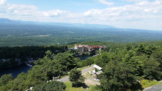
About 2.25 miles from the start of the hike, there is a scenic viewpoint which provided a great spot for a break. Right in front of us lay our destination, Sugarloaf Mountain. At 3,800' it is the 13th highest in the Catskills above 3,500'. Once I reached the top, it would be my 24th climb out of the required 39 to become a member of the Catskills 3500 club. I would officially be able to call myself a 35er once I climb 15 more mountains.
We paused here for a snack and to enjoy the view.
After this lookout, the trail would drop off a few hundred feet. About a half mile ahead was the intersection with the red blazed Devil's Path. For the more experienced and ambitious hikers (me when I'm solo), one could make a right and begin the short yet very steep route up to Plateau Mountain and back again. An 11-12 mile loop hike could net you Twin, Sugarloaf and Plateau for those willing to put in the work. Had I not been car-less this particular weekend I would have planned for that rough and long day. As it were I was at the mercy of my ride, and he wasn't going to do that trek.
Making a left onto the Devil's Path, we would ascend 1,200 feet in a little over a mile. The trail began its rise immediately from the junction. Rocky and steep would be the way for the next 45 minutes or so. It would also be riddled with black ice.
There was one particular very steep section of the trail completely iced over. Had we all been in possession of crampons we would have made it up and over much easier. A lone, thin downed tree would serve as our only leverage to help cross this ice.
Crossing 3,500', frozen snow fell from the pines with light winds nudging them along. It made for a picturesque scene on a brisk Spring day. Reaching the top of the climb after encountering more ice and some other ill prepared day trippers, there lay a yellow marked spur trail that leads to another viewpoint. Since the summit was less than 100 yards up the trail, unmarked with no view, we took this point as our lunch break. We all sat or laid on the rock, basking in the sun and eating our fare.
After lunch we made our way back to the red trail. It would level off for a short while before taking a deep plunge that seemed it would never end. A few nice views on the way down made it a bit more bearable, though my knees would disagree.
The next turn would be left onto the blue marked Pecoy Notch trail. The distance from here back to the yellow Roaring Kill trail was 1.75 miles. The map called out Dibble's Quarry about halfway down with a view.
A rock quarry that ceased operations in the late 1800's had been transformed by an anonymous group or groups of people into a throne room with a fantastic view. Several chairs and even a staircase had been built. Rumor has it that bluestone from this quarry was used in the construction of some New York City sidewalks. As for this respite in the middle of the mountains, it makes for a sweet spot to relax, especially on a sunny day.
A short time later we were back at the junction with the yellow trail and made our way towards the parking lot. As we passed the trail register I signed us out. We would reconvene at the house for pizza and beer - a well deserved reward for a great effort.
This is definitely a tough hike for those looking to take the leap from beginner to intermediate hiking. You'll feel accomplished when you finish, and the physical demands of the climb and descent are well worth it.
Parking: 42.150949, -74.131138 Roaring Kill Trailhead, Elka Park, NY
Mileage: 7
Time: 4-6 hours
Gear:
After what I consider a very long layoff, I was out on the trails again with some friends from the Tristate Outdoors Group (meetup.com). My buddy Steve rented a house in Hunter for the weekend and the weather was perfect for a hike. A local layover 15 minutes from the trailhead is always a great way to explore the area without the long drives.Gear:
- daypack
- 2.5-3L of water
- lunch, snacks
- first aid
- tape
- knife
- water filter
- compass
- trekking poles
- extra layer; hat
- micro spikes
- map - New York New Jersey Trail Conference #141
- hiking boots
- NO COTTON - Why no cotton? Cotton is a thicker material and isn't as breathable as synthetic materials. Once it's wet, it becomes heavier and takes longer to dry.
There were 4 of us and this trek was to be done at a leisurely pace. Based on the map, there would be a steep ascent and a steep return trip down the mountain. Winter often lasts well into April and even May in the Catskills. There was sure to be ice at the higher elevations (+3,000'). Our route would take us along the Devil's Path, said to be the most rugged trail of ups and downs in the Northeast. It is notorious for being very icy and difficult to traverse in the colder months. I had been on other parts of this trail and it is aptly named. This day would offer nothing different than I had previously experienced.
Beginning around 10 a.m. we made our way up the yellow Roaring Kill trail that would connect us to a Y intersection. The register was a short distance from the parking lot; I signed the group in and we proceeded. At the trail junction just .25 miles away, we took a right onto the blue Mink Hollow Trail. We would be very happy this was the direction we took. As it turned out, the hike down this trail would've been extremely difficult. You'll see why.
As we made our way up Mink Hollow, we encountered lots of melting ice and icicles hanging from rocks and boulders. A gradual incline became steeper and we pressed forward. The air was cool and crisp at 45 degrees; there was hardly a cloud in the sky and the sun shone bright.
About 2.25 miles from the start of the hike, there is a scenic viewpoint which provided a great spot for a break. Right in front of us lay our destination, Sugarloaf Mountain. At 3,800' it is the 13th highest in the Catskills above 3,500'. Once I reached the top, it would be my 24th climb out of the required 39 to become a member of the Catskills 3500 club. I would officially be able to call myself a 35er once I climb 15 more mountains.
We paused here for a snack and to enjoy the view.
After this lookout, the trail would drop off a few hundred feet. About a half mile ahead was the intersection with the red blazed Devil's Path. For the more experienced and ambitious hikers (me when I'm solo), one could make a right and begin the short yet very steep route up to Plateau Mountain and back again. An 11-12 mile loop hike could net you Twin, Sugarloaf and Plateau for those willing to put in the work. Had I not been car-less this particular weekend I would have planned for that rough and long day. As it were I was at the mercy of my ride, and he wasn't going to do that trek.
Making a left onto the Devil's Path, we would ascend 1,200 feet in a little over a mile. The trail began its rise immediately from the junction. Rocky and steep would be the way for the next 45 minutes or so. It would also be riddled with black ice.
There was one particular very steep section of the trail completely iced over. Had we all been in possession of crampons we would have made it up and over much easier. A lone, thin downed tree would serve as our only leverage to help cross this ice.
Crossing 3,500', frozen snow fell from the pines with light winds nudging them along. It made for a picturesque scene on a brisk Spring day. Reaching the top of the climb after encountering more ice and some other ill prepared day trippers, there lay a yellow marked spur trail that leads to another viewpoint. Since the summit was less than 100 yards up the trail, unmarked with no view, we took this point as our lunch break. We all sat or laid on the rock, basking in the sun and eating our fare.
After lunch we made our way back to the red trail. It would level off for a short while before taking a deep plunge that seemed it would never end. A few nice views on the way down made it a bit more bearable, though my knees would disagree.
The next turn would be left onto the blue marked Pecoy Notch trail. The distance from here back to the yellow Roaring Kill trail was 1.75 miles. The map called out Dibble's Quarry about halfway down with a view.
A rock quarry that ceased operations in the late 1800's had been transformed by an anonymous group or groups of people into a throne room with a fantastic view. Several chairs and even a staircase had been built. Rumor has it that bluestone from this quarry was used in the construction of some New York City sidewalks. As for this respite in the middle of the mountains, it makes for a sweet spot to relax, especially on a sunny day.
 |
| The Doc and Felina take the King and Queen chairs overlooking the valley |
This is definitely a tough hike for those looking to take the leap from beginner to intermediate hiking. You'll feel accomplished when you finish, and the physical demands of the climb and descent are well worth it.


Comments
Post a Comment