North Dome & Mt. Sherrill: Hunter-West Kill Wilderness
Venture off trail and bushwhack your way through the mountain wilderness to these two Catskill 3500 peaks.

Parking: 42.191882, -74.325538 Devil's Path West Terminus, Spruceton Rd., West Kill, NY
Miles: 9-10 (My Fitbit had my at 12+ though)
Hours: 7-9

Gear:
- daypack
- 3L of water
- lunch, snacks
- first aid
- tape
- knife
- water filter
- compass
- Counter Attack Bear Spray
- GPS
- trekking poles
- map - New York New Jersey Trail Conference #142
- hiking boots
- NO COTTON - Why no cotton? Cotton is a thicker material and isn't as breathable as synthetic materials. Once it's wet, it becomes heavier and takes longer to dry.
Working on completing my Catskills 3500 peaks, I have left all the bushwhacks for last. The forecast was for 60's and 70's throughout the Hudson Valley, and thankfully it held. It was a gorgeous day for a long hike.
This trek starts out on the Devil's Path at it's western terminus. The first 1.5 miles on the trail are a gradual climb up to about 2,400'. The register is within site of the parking lot. Following the red markers as they meander through the woods, I would come upon a hard left turn that would lead up to St. Anne's Peak at 3,420'. This is where the off trail adventure begins. Turning west and following a bearing of 264°, I looked up and saw my destination. Amid the switchbacks and disorientation, I would be constantly checking my bearing to be sure I was on course. The topography of the maps told me it would be a steep climb but I had no idea what lay in store.


Moving through the thick, leafless brush always slows you down. I can normally move 2-2.5 mph over any terrain, but this bobbing and weaving through bare shrubbery is tedious. Each step and each turn is deliberate and purposeful. As the ground began to rise, the pace slowed. Soon I was a few hundred feet up and the angle of the mountainside was getting greater and greater, approaching 45° or more. Leaf cover made the footing unstable, not to mention that each time I grabbed at or stepped on a rock it slid out from under my boot and tumbled down the hill.


As I crept up the side of the mountain I glimpsed the first set of rock ledges I needed to traverse. There were few easy ways up, but why take the easy way? I typically look for the harder route because it is always more challenging and fun. This instance would be no different. I decided on a course and made my scramble. When I was over the hump, I saw the next ledge. I took the same action and selected a rough ascent. The only mistake of the day was not hydrating on the drive to the trail. At this early stage of the hike I was already getting dry mouth, a tell tale sign of dehydration. Luckily and thankfully, snow and ice melt left the opportunity for water.


Flowing off the moss were the remnants of a mild winter. Little snow and ice remained, but what did remain was my reward. I retrieved my "dirty bag" and stood while the slow drip of clean water filled it. You wouldn't think it would be clean coming off the moss, but it was as clear as any freshwater stream. I attached my filter and gorged myself. I figured I'd be good for the remainder of the day. Nope.
After my water break I proceeded up the rise towards the final set of rocks and ledges. I spied a crack I knew I could fit through. It looked to be more fun than scrambling up and around some other open breaks in the boulders. The climber in me couldn't resist, if only for a short distance.


Checking my altimeter, I had surpassed 3,500' and was very close to the summit. I located a spectacular perch and sat down for lunch and meditation. I enjoyed my break and admired the scenery, reminded again of how minuscule we are.


After my short meditation and before I left this scenic view, I took off my bracelet and snapped this photo. Mike DiGoia was a classmate, more than an acquaintance but less than a close friend. He was loved by everyone and reciprocated that love to the world around him. His fearless travels around the world, throwing caution to the wind and following his gut were and still are an inspiration to many. He'd go around the world to find himself, as I have done since I began hiking. He is probably the only person I've known who is truly worthy of being called The Man. Very few were enlightened to live and to what life is like he was. I only hope my own state of being can continue to progress and come within a short distance of his. Mike has been encouragement to continue my personal growth since he first posted his travel photos on FB.
I continued the short distance that remained to the summit. Returning to the bearing of West 264°, it took me little time to find the register. I snapped a photo of myself and moved on.

I oriented myself and followed a similar western bearing at about 271°. The route down to the col between North Dome and Mount Sherrill wasn't too steep as I descended to an elevation around 3,000'. I lucked out again as runoff created a tiny flow falling just enough for me to filter water from. I hydrated here, topped off my reservoir and proceeded. The bush was intermittently thick and thin along the way. It was obvious when I had reached the bottom of my decline.
The route up Mt. Sherrill wasn't nearly as steep as that of North Dome. It was also a shorter distance, having only +/- 500' to reach the top.
As I made it past 3,500' I began to search for the summit register. I was told there was a herd path at the top that was easy to follow, but I most certainly could not find it due to my course of travel. As I looked around I heard a few voices call out in excitement. "This one was easy to find." The hell it was!
I turned immediately and knew someone had found the canister. I follow the voices and it turns out I was not far off at all. I was greeted happily by a great couple from Plainview, NY (Long Island). Marielle and Donald were on the same trek as I. We rested and snacked and chatted at the summit. Since we were all headed in the same direction, we departed together to finish the day as a trio. Along the way we swapped stories of LI, work and our hiking adventures. I can only hope to make some of the trips they had made, like the summit of Mt. Katahdin in Maine. This peak is the highest in Maine and the northern terminus of the Appalachian Trail.
The hike downhill was steep with thick brush and uneventful surroundings. It wasn't until we reached the bottom of the mountain that we caught a glimpse of West Kill, the brook that runs parallel to Spruceton Rd. We sauntered alongside the water until I wanted to take a closer look for a crossing. The flow was pretty strong and there was no easy way across. The best course of action was to continue on our heading towards a small bridge and private road just a few minutes away. Before we could reach the crossing we were treated to a beautiful waterfall, one we wouldn't have spotted had we chosen another path. We took a few minutes here to take pictures and splash cool water on our exhausted and perspired faces.


It wasn't long after that we reached our bridge and the road walk back to the parking lot. A day that began as another solo outing ending pleasantly having met some great people on the trail, again.
We all made our way back to the register to sign ourselves out. I was grateful and delighted to have met Marielle and Don. Hopefully we will meet again on the trails, or even plan something together in the future.
This trek starts out on the Devil's Path at it's western terminus. The first 1.5 miles on the trail are a gradual climb up to about 2,400'. The register is within site of the parking lot. Following the red markers as they meander through the woods, I would come upon a hard left turn that would lead up to St. Anne's Peak at 3,420'. This is where the off trail adventure begins. Turning west and following a bearing of 264°, I looked up and saw my destination. Amid the switchbacks and disorientation, I would be constantly checking my bearing to be sure I was on course. The topography of the maps told me it would be a steep climb but I had no idea what lay in store.


Moving through the thick, leafless brush always slows you down. I can normally move 2-2.5 mph over any terrain, but this bobbing and weaving through bare shrubbery is tedious. Each step and each turn is deliberate and purposeful. As the ground began to rise, the pace slowed. Soon I was a few hundred feet up and the angle of the mountainside was getting greater and greater, approaching 45° or more. Leaf cover made the footing unstable, not to mention that each time I grabbed at or stepped on a rock it slid out from under my boot and tumbled down the hill.


As I crept up the side of the mountain I glimpsed the first set of rock ledges I needed to traverse. There were few easy ways up, but why take the easy way? I typically look for the harder route because it is always more challenging and fun. This instance would be no different. I decided on a course and made my scramble. When I was over the hump, I saw the next ledge. I took the same action and selected a rough ascent. The only mistake of the day was not hydrating on the drive to the trail. At this early stage of the hike I was already getting dry mouth, a tell tale sign of dehydration. Luckily and thankfully, snow and ice melt left the opportunity for water.


Flowing off the moss were the remnants of a mild winter. Little snow and ice remained, but what did remain was my reward. I retrieved my "dirty bag" and stood while the slow drip of clean water filled it. You wouldn't think it would be clean coming off the moss, but it was as clear as any freshwater stream. I attached my filter and gorged myself. I figured I'd be good for the remainder of the day. Nope.
After my water break I proceeded up the rise towards the final set of rocks and ledges. I spied a crack I knew I could fit through. It looked to be more fun than scrambling up and around some other open breaks in the boulders. The climber in me couldn't resist, if only for a short distance.


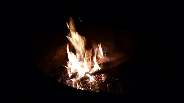
 |
| Looks are deceiving. This photo hardly captures the fun. |

Checking my altimeter, I had surpassed 3,500' and was very close to the summit. I located a spectacular perch and sat down for lunch and meditation. I enjoyed my break and admired the scenery, reminded again of how minuscule we are.


After my short meditation and before I left this scenic view, I took off my bracelet and snapped this photo. Mike DiGoia was a classmate, more than an acquaintance but less than a close friend. He was loved by everyone and reciprocated that love to the world around him. His fearless travels around the world, throwing caution to the wind and following his gut were and still are an inspiration to many. He'd go around the world to find himself, as I have done since I began hiking. He is probably the only person I've known who is truly worthy of being called The Man. Very few were enlightened to live and to what life is like he was. I only hope my own state of being can continue to progress and come within a short distance of his. Mike has been encouragement to continue my personal growth since he first posted his travel photos on FB.
Taken too soon and too suddenly, his loss is great to an immeasurable amount of people. Rest in peace Mike
I continued the short distance that remained to the summit. Returning to the bearing of West 264°, it took me little time to find the register. I snapped a photo of myself and moved on.


I oriented myself and followed a similar western bearing at about 271°. The route down to the col between North Dome and Mount Sherrill wasn't too steep as I descended to an elevation around 3,000'. I lucked out again as runoff created a tiny flow falling just enough for me to filter water from. I hydrated here, topped off my reservoir and proceeded. The bush was intermittently thick and thin along the way. It was obvious when I had reached the bottom of my decline.
The route up Mt. Sherrill wasn't nearly as steep as that of North Dome. It was also a shorter distance, having only +/- 500' to reach the top.
As I made it past 3,500' I began to search for the summit register. I was told there was a herd path at the top that was easy to follow, but I most certainly could not find it due to my course of travel. As I looked around I heard a few voices call out in excitement. "This one was easy to find." The hell it was!
I turned immediately and knew someone had found the canister. I follow the voices and it turns out I was not far off at all. I was greeted happily by a great couple from Plainview, NY (Long Island). Marielle and Donald were on the same trek as I. We rested and snacked and chatted at the summit. Since we were all headed in the same direction, we departed together to finish the day as a trio. Along the way we swapped stories of LI, work and our hiking adventures. I can only hope to make some of the trips they had made, like the summit of Mt. Katahdin in Maine. This peak is the highest in Maine and the northern terminus of the Appalachian Trail.
The hike downhill was steep with thick brush and uneventful surroundings. It wasn't until we reached the bottom of the mountain that we caught a glimpse of West Kill, the brook that runs parallel to Spruceton Rd. We sauntered alongside the water until I wanted to take a closer look for a crossing. The flow was pretty strong and there was no easy way across. The best course of action was to continue on our heading towards a small bridge and private road just a few minutes away. Before we could reach the crossing we were treated to a beautiful waterfall, one we wouldn't have spotted had we chosen another path. We took a few minutes here to take pictures and splash cool water on our exhausted and perspired faces.


It wasn't long after that we reached our bridge and the road walk back to the parking lot. A day that began as another solo outing ending pleasantly having met some great people on the trail, again.
We all made our way back to the register to sign ourselves out. I was grateful and delighted to have met Marielle and Don. Hopefully we will meet again on the trails, or even plan something together in the future.

Comments
Post a Comment