Weekend Backpacking in Harriman St. Park: Saturday
An overcast and rainy day turned out not so bad.
Starting Point: Shelter/camp area off the White Bar trail, .25 mi south of Orange County Route 106
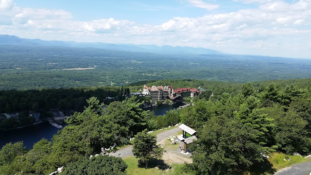
 |
| Big Hill shelter along the Long Path |
Saturday Mileage: 7.75
Hike Time: 4 hours
Saturday began with some light rain around sunrise. The sound of rain drops on a tent is quite pleasant and soothing (I have fallen asleep very easily once before to the sound of pounding rain on my tent). Peeling back the rear flap on my tent exposed a nice breeze and the orange hue of a sunrise. I immediately crawled out of my tent to catch a glimpse of the morning sky before the clouds took over. As I retrieved my food bag from the tree in which I had hung it the night before, a rainbow arched over Lake Stahahe. I drop everything to grab a few snaps before it disappeared.


As the rain fell I started to gather myself and cook the breakfast of champions: dehydrated rice and beans! Easy to prepare and full of protein it would provide me with great calories and energy for my morning. After eating I packed up and reviewed map for the day's route. Only 3 trails would be utilized today: White Bar, Yellow Dunning and the Long Path. Easy enough.
Just .25 mile north I would cross over Orange County Route 106 and a parking area. The trail descends a little bit to the lot, then levels off some after crossing the road. Shortly thereafter the trail merges with the White Nurian for about .25 mile. After breaking right and remaining on the White Bar, the path rises gently through some brush and rolls along for .5 miles then merges with the Yellow Dunning trail. Continuing on a semi-level grade I turned right to stay on the Dunning after it split from the WB. The next mile or so would climb steadily to some exposed rock. I was a little nervous on this portion of trail. The sky was grey and the threat of rained loomed large.
It was just over a year ago, when in the same general area on the Ramapo Dunderberg trail I was caught in an absolute downpour on the exposed rock. Without cover while thunder roared loudly, I panicked for about 30 seconds imagining a lighting strike. To top it off I lost track of the trail markers. I staggered to and fro trying to locate the blazes while I was drenched with sheets of rain. When I was finally able to follow the trail down and under the canopy of leaves, my boots were completely water logged. It took days to dry out, and they still stink to this day (and that is why I bought my current pair).
With this memory at the forefront of my mind, I picked up the pace as much as possible, knowing that the trail would descend into thicker bush. Despite the lack of leaves on the trees they still provided some cover. After passing the RD I would make it to the forest below with just a few drops to show for my nervous paranoia. It wouldn't be long before I noticed the remnants of the Hogencamp mine to my left; the Long Path was not far.


The Long Path is a 357 mile long trail stretching from the George Washington Bridge in Fort Lee, NJ to Altamont, NY (which is just west of Albany). It can be completed as a thru-hike in about a month. There are sections in which to camp yet others in which you must leave the trail to stay in a motel.
At the intersection with the Long Path I took a right. I'd follow this trail to the Big Hill shelter where I would make camp for the night. The terrain was easy, just as it had been thus far on my outing. I had planned it that way. I just wanted to be out in the park without any real difficult trekking. I had been pushing myself all year to summit Catskill peaks and hadn't really had a break from that stuff. A weekend of easy hiking and campfires was just what the outdoor Dr. ordered.
Break time would come at the parking area between Lake Skannatati and Lake Askoti; first one of the morning (2 hours and about 4 miles in). By this time the rain had started again. Sitting by the lake I had a snack and refilled my water supply as the parking lot filled with day hikers and dogs ready to enjoy the overcast day. I was doing great on time despite not being in a rush so I loitered a bit and extended my break. I knew I'd reach camp early and was looking forward to napping in the shelter when I arrived.


From the lake area to camp, I would cross over Route 106 and Lake Welch Drive. Again, terrain was pretty level. Any inclines where slight. After passing the blue Beech Trail and then Lake Welch Dr, I came upon something completely unexpected. I noticed the sign in the distance and thought to myself "this isn't an historic trail or anything, what is that?" It was a memorial site.
On December 1, 1974, Northwest Orient Airlines Flight 6231 took off from JFK International Airport bound for Buffalo, NY. It was a charter flight set to pick up the NFL's Baltimore Colts. The original charter due to arrive from Detroit was snowed in. There were only 3 crew members aboard: Captain John B. Lagorio, 1st Officer Walter A. Zadra and 2nd Officer James F. Cox. As the aircraft passed 16,000 feet an overspeed warning horn sounded followed by a stall warning. After leveling off at 24,800 feet, the plane begin its fatal and horrific descent towards the ground. The aircraft stalled and the crew could not regain control. The plane spun as it dove, reaching an acceleration of +5g. It struck the ground violently 12 minutes after takeoff at 7:26pm. The cause of the crashed was determined to be a malfunction of a pitot head due to icing. This icing is what triggered the false overspeed warning. The crew heeded the warning as if they were correct (similar to the crash of Air France Flight 447 on June 1, 2009). The sign was erected just his year as a memorial to those lost.
I am not religious at all so I did not say a prayer, however I bowed my head in a moment of silence and respect. I was standing on the spot where 3 men lost there lives in a tragic accident. After the eerie feeling passed, I continued on.


Nearly 2 miles later I would reach the Big Hill Shelter. The path would climb a few hundred feet to reveal a great southern view of the park, Pomona, NY and surrounding communities. The view is so fantastic that you can see the NYC skyline. As the clouds dissipated somewhat later that night, I did indeed see the lights of the world's most iconic skyline. I don't have a camera good enough to capture the shot but the memory is bright in my mind.
I didn't get to relax for long or take my nap. Just moments after plopping down in the shelter I was joined by a nice couple, their friend and 2 children enjoying a day hike and camp-like picnic. Persons encountered on the trail are typically very sweet and generous, as we are all out to enjoy the same thing. My new friends were kind enough to offer me part of their feast: hot chocolate, salami and cheese, vegetarian soup and roasted marshmallows. It was another nice surprise. As they departed nearly an hour later I was grateful for their generosity and company, for the time spent was anticipated to be alone and with meager rations.
Due to the day's precipitation I knew finding dry wood would be a challenge. This was my 3rd surprise of the day. Previous campers had left some very nice logs under the cover of the shelter. There were some other larger, slightly rotted pieces out in the rain next to the fire pit. Removing some off the stack I found dry wood below, adding it to the pile already discovered. Some of the branches had cracks and fractures in them. I was able to split these into smaller pieces and also pull shards to use as tinder.
I found a decent spot to pitch my tent after getting the firewood situated. By this time the rain had stopped. I then set up my food bag, leaving the rope accessible so I could hoist my food into the air after dinner. Despite the low risk of bears this time of year it is always wise to hang your food. Nocturnal animals like raccoons, rabbits, mice and opossum will want a taste of what you've got.
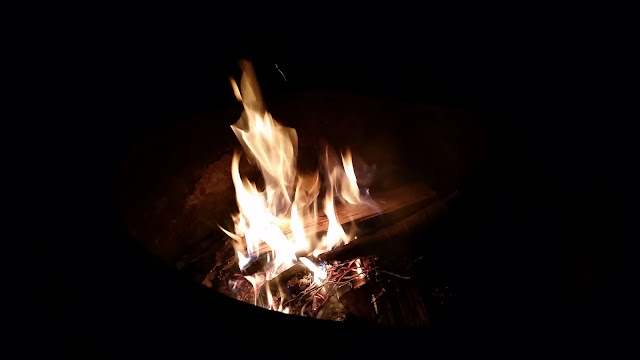
As time passed and daylight faded I allowed nightfall to set in before getting my fire going. Dinner and my evening activity would be the same as Friday: flavored pasta and a book by the fire.


The forecast called for colder temperatures overnight and into the morning. My hike out would be a the coldest of the weekend...
Saturday began with some light rain around sunrise. The sound of rain drops on a tent is quite pleasant and soothing (I have fallen asleep very easily once before to the sound of pounding rain on my tent). Peeling back the rear flap on my tent exposed a nice breeze and the orange hue of a sunrise. I immediately crawled out of my tent to catch a glimpse of the morning sky before the clouds took over. As I retrieved my food bag from the tree in which I had hung it the night before, a rainbow arched over Lake Stahahe. I drop everything to grab a few snaps before it disappeared.


Just .25 mile north I would cross over Orange County Route 106 and a parking area. The trail descends a little bit to the lot, then levels off some after crossing the road. Shortly thereafter the trail merges with the White Nurian for about .25 mile. After breaking right and remaining on the White Bar, the path rises gently through some brush and rolls along for .5 miles then merges with the Yellow Dunning trail. Continuing on a semi-level grade I turned right to stay on the Dunning after it split from the WB. The next mile or so would climb steadily to some exposed rock. I was a little nervous on this portion of trail. The sky was grey and the threat of rained loomed large.
It was just over a year ago, when in the same general area on the Ramapo Dunderberg trail I was caught in an absolute downpour on the exposed rock. Without cover while thunder roared loudly, I panicked for about 30 seconds imagining a lighting strike. To top it off I lost track of the trail markers. I staggered to and fro trying to locate the blazes while I was drenched with sheets of rain. When I was finally able to follow the trail down and under the canopy of leaves, my boots were completely water logged. It took days to dry out, and they still stink to this day (and that is why I bought my current pair).
With this memory at the forefront of my mind, I picked up the pace as much as possible, knowing that the trail would descend into thicker bush. Despite the lack of leaves on the trees they still provided some cover. After passing the RD I would make it to the forest below with just a few drops to show for my nervous paranoia. It wouldn't be long before I noticed the remnants of the Hogencamp mine to my left; the Long Path was not far.


The Long Path is a 357 mile long trail stretching from the George Washington Bridge in Fort Lee, NJ to Altamont, NY (which is just west of Albany). It can be completed as a thru-hike in about a month. There are sections in which to camp yet others in which you must leave the trail to stay in a motel.
At the intersection with the Long Path I took a right. I'd follow this trail to the Big Hill shelter where I would make camp for the night. The terrain was easy, just as it had been thus far on my outing. I had planned it that way. I just wanted to be out in the park without any real difficult trekking. I had been pushing myself all year to summit Catskill peaks and hadn't really had a break from that stuff. A weekend of easy hiking and campfires was just what the outdoor Dr. ordered.
Break time would come at the parking area between Lake Skannatati and Lake Askoti; first one of the morning (2 hours and about 4 miles in). By this time the rain had started again. Sitting by the lake I had a snack and refilled my water supply as the parking lot filled with day hikers and dogs ready to enjoy the overcast day. I was doing great on time despite not being in a rush so I loitered a bit and extended my break. I knew I'd reach camp early and was looking forward to napping in the shelter when I arrived.
 |
| Right turn here on the teal blazed Long Path |


From the lake area to camp, I would cross over Route 106 and Lake Welch Drive. Again, terrain was pretty level. Any inclines where slight. After passing the blue Beech Trail and then Lake Welch Dr, I came upon something completely unexpected. I noticed the sign in the distance and thought to myself "this isn't an historic trail or anything, what is that?" It was a memorial site.
On December 1, 1974, Northwest Orient Airlines Flight 6231 took off from JFK International Airport bound for Buffalo, NY. It was a charter flight set to pick up the NFL's Baltimore Colts. The original charter due to arrive from Detroit was snowed in. There were only 3 crew members aboard: Captain John B. Lagorio, 1st Officer Walter A. Zadra and 2nd Officer James F. Cox. As the aircraft passed 16,000 feet an overspeed warning horn sounded followed by a stall warning. After leveling off at 24,800 feet, the plane begin its fatal and horrific descent towards the ground. The aircraft stalled and the crew could not regain control. The plane spun as it dove, reaching an acceleration of +5g. It struck the ground violently 12 minutes after takeoff at 7:26pm. The cause of the crashed was determined to be a malfunction of a pitot head due to icing. This icing is what triggered the false overspeed warning. The crew heeded the warning as if they were correct (similar to the crash of Air France Flight 447 on June 1, 2009). The sign was erected just his year as a memorial to those lost.
I am not religious at all so I did not say a prayer, however I bowed my head in a moment of silence and respect. I was standing on the spot where 3 men lost there lives in a tragic accident. After the eerie feeling passed, I continued on.


Nearly 2 miles later I would reach the Big Hill Shelter. The path would climb a few hundred feet to reveal a great southern view of the park, Pomona, NY and surrounding communities. The view is so fantastic that you can see the NYC skyline. As the clouds dissipated somewhat later that night, I did indeed see the lights of the world's most iconic skyline. I don't have a camera good enough to capture the shot but the memory is bright in my mind.
I didn't get to relax for long or take my nap. Just moments after plopping down in the shelter I was joined by a nice couple, their friend and 2 children enjoying a day hike and camp-like picnic. Persons encountered on the trail are typically very sweet and generous, as we are all out to enjoy the same thing. My new friends were kind enough to offer me part of their feast: hot chocolate, salami and cheese, vegetarian soup and roasted marshmallows. It was another nice surprise. As they departed nearly an hour later I was grateful for their generosity and company, for the time spent was anticipated to be alone and with meager rations.
Due to the day's precipitation I knew finding dry wood would be a challenge. This was my 3rd surprise of the day. Previous campers had left some very nice logs under the cover of the shelter. There were some other larger, slightly rotted pieces out in the rain next to the fire pit. Removing some off the stack I found dry wood below, adding it to the pile already discovered. Some of the branches had cracks and fractures in them. I was able to split these into smaller pieces and also pull shards to use as tinder.
I found a decent spot to pitch my tent after getting the firewood situated. By this time the rain had stopped. I then set up my food bag, leaving the rope accessible so I could hoist my food into the air after dinner. Despite the low risk of bears this time of year it is always wise to hang your food. Nocturnal animals like raccoons, rabbits, mice and opossum will want a taste of what you've got.
As time passed and daylight faded I allowed nightfall to set in before getting my fire going. Dinner and my evening activity would be the same as Friday: flavored pasta and a book by the fire.


The forecast called for colder temperatures overnight and into the morning. My hike out would be a the coldest of the weekend...

Comments
Post a Comment