Adirondack High Peaks: Dix Range Traverse
Parking: 44.020858,-73.827868 Elk Lake Rd, North Hudson, NY
Miles: 14-15
Hours: 9-11
My Gear:
- daypack
- 4L water
- snacks
- first aid
- tape
- compass
- Counter Attack Bear Spray (just in case - rather be safe than dead!)
- knife
- hiking boots
- trekking poles
- map - National Geographic #742
- synthetic clothing - extra shirts (long and short sleeve)
- NO COTTON - Why no cotton? Cotton is a thicker material and isn't as breathable as synthetic materials. Once it's wet, it becomes heavier and takes longer to dry.
The Adirondack High Peaks wilderness is home to the tallest mountains in New York State. Known as the Adirondack 46's, there are 46 peaks that sit at 4,000' above sea level. Those that climb to each summit are labeled a Forty-Sixer; much like those who climb the 35 Catskill peaks above 3,500' are known as Thirty Fivers. Many of the summits are trail-less bushwhacks, making the feat even more arduous.
The Dix Range is comprised of 5 mountains: Mt. Dix 4,857', Hough 4,409', South Dix 4,060', East Dix 4,006' and Macomb Mountain 4,405'. Each is named after a prominent American who contributed greatly to the Empire State. The Dix peaks were named for John A. Dix who served as New York's Secretary of State under Governor William L. Marcy, was a Union major general during the Civil War and later would become governor himself. Macomb Mountain is named for Alexander Macomb, who defeated the British in the Battle of Plattsburgh on September 11, 1814. Hough Peak is named for Franklin B. Hough. A conservationist and American forester, Franklin Hough was born and raised on the western edge of the Adirondack region. I would summit all but East Dix on this hike, sticking to my plan and not straying from the loop.
The Elk Lake Rd. approach is the one I used. It is not accessible during the big game hunting season (2nd to last Saturday of October - 1st Sunday of December); the road is also closed 3.3 miles from the trailhead during the winter months. Much of the land at the start of this hike is privately owned, so observe proper etiquette and respect the landowner's privacy.
After signing in at the trail register, the first 2 miles of trail are level but rocky. There are a few stream crossings but nothing treacherous in the summer months. Keep your eyes and ears open - this is Black Bear country. The Adirondack black bears are notoriously NOT shy around humans. They have gotten used to our presence and learned that many of us are careless with our food. Bear spray is the best deterrent should one actually get close enough for a charge. Keep it on your belt for fast deployment, for there will be NO time to retrieve it from your pack. Once you reach the primitive camping area and lean-to at Slide Brook, there will be a cairn on your right and a sign pointing towards the unmarked path leading to Macomb. The trail is clear at your feet, and soon becomes a steady, steep march with the Slide Brook on your right. After almost a mile the trail begins to pull away from the brook and reaches the clearing of the Macomb rock slide. Scramble up at a 45* angle about 800' to the top of the slide where there is a large boulder. There are cairns marking the best and most sure-footed route. After this boulder the trail weaves up a few more rocks and through some trees to the summit. Take breaks as needed. It is advised to snack on a protein bar or other sugary treat before the climb. Admire the views and snap some photos, but this is only the beginning!
 |
| Looking down from where the trail enters the slide |
 |
| One of the many cairns on the slide. And me! Views from the boulder at the top of the slide |
The summit of Macomb Mountain is marked with a small sign and a geological stamp in the rock.
Continue to follow the unmarked herd path as it will descend into the col before climbing again to South Dix Mountain. Along the way is another cairn - take a left at this one and look for the path on the ground. Just before the summit is open rock with more soaring views of the valley below and high peaks around you. Follow the cairns up as the path ducks into the trees. There is an intersection marked with another cairn - this is the summit of South Dix and junction to East Dix. Making a right will take you on an easy trek to East Dix which I am told has awesome views. I proceeded left on the herd path towards Hough Peak, sticking to my plan.
There are a few open ledges with more views. Just before the summit of Hough Peak are some tricky boulders to navigate around. There are good hand and foot holds to climb to get some more views. Proceed to the summit a short distance later where a trail marker notes the peak.
After Hough peak comes the best part of the day. Descending into a col and climbing steeply again, the Beckhorn is an open rock ridge above 4,000' just 1/2 mile from Dix Mountain. It is not considered a separate peak due to its proximity and shared mountainside with Dix.
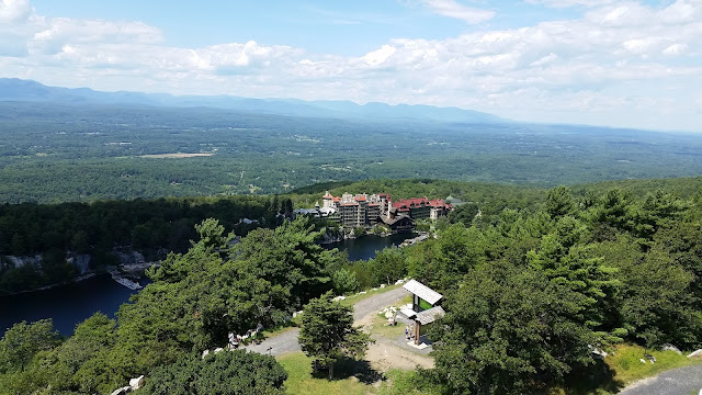
Before you reach the Beckhorn however, there are some open ledges to stop at and take notice of where you came from and where you are going. It is a great feeling to be able to see the mountains you just traversed and those that you are about to; all from the same spot.
 |
| Next stop, Dix Mountain! |
Dix Mountain - the reason why I made this trek. It is the highest elevation I have been at thus far in my hiking career. Reaching the 6th tallest mountain in New York via 3 other peaks made it all the more gratifying. I had never done a hike like this before - traversing several mountains above an alpine zone, climbing steeply and relentlessly between each one. The mileage was not the issue this time, the mountains were. I am proud to say that this will be the first of many hikes of this magnitude.
There are a few spots at the summit; the second one is the official peak, marked with a geological stamp in the rock, just like on Macomb. I could've stayed at the peak all day, admiring the views, realizing how insignificant humans really are in this giant landscape.
Having made my day, the remainder of the afternoon would be a 7+ mile hike downhill back to the parking lot. Taking the Beckhorn trail down, I had read trail reports that this was kind of foolish since the way up was pretty steep. The alternative was to add an additional 3/4 of mile to go around Hunter's Pass. At the summit of Hough I had run into another solo hiker who told me the way up was not really that bad. I decided to take the Beckhorn down and avoid the added time and mileage. That hiker was right; it really wasn't that bad - nothing I hadn't descended before. A little over 2 miles later I would come to the Red #119 trail (Dix via Hunter' Pass). Making a left here the final 3.8 miles would be an easy walk in the woods.
On the way is Lillian Brook, a strong running stream with icy cold water. It is a nice spot to take a dip and cool off on a hot day. Even though I still had water left it was kind of warm at this point. I drank some ice cold water and it was quite refreshing. After crossing the bridge there is a trail to a lean-to and primitive camping area.
The remaining miles are uneventful as I would come to the Slide Brook lean-to and camping area where the herd path to Macomb is. Leaving on the same trail section in which I entered, I had a chance to slow down and reflect on the day I just had. Despite the mileage and elevation gain (over 3,000' in total) my body felt fresh with the exception of my feet of course. Pride and confidence took hold as I looked forward to relaxing at my campsite with some cold beers by the fire.


Comments
Post a Comment