Giant Ledge & Panther Mountain
Parking: Route 47/Oliverea Rd, Phoenicia, NY – Giant Ledge Trailhead parking
Miles: 6.8
Hours: 6 - 8
You can do this as a quick overnight or a day hike.
What I took for a quick overnight:
- 2L water (top off at the spring before the Giant Ledge)
- Dinner, snacks, breakfast, lunch
- Overnight pack - 62L capacity
- First aid
- Knife
- Tape
- Compass
- Map - New York New Jersey Trail Conference #142
- Trekking poles
- Synthetic clothing
- NO COTTON - Why no cotton? Cotton is a thicker material and isn't as breathable as synthetic materials. Once it's wet, it becomes heavier and takes longer to dry.
- Hiking boots or trail running shoes
- Sleeping bag
- Sleeping pad
- Inflatable mini pillow
- Tent
- Ground tarp/tent footprint
- Headlamp
- mini lantern
- 550 Para cord
- Carabiners
- Stove
- Cook-set
- Waterproof matches, lighter
- Vaseline/petroleum jelly lathered cotton balls
- Water filter
- Bug repellent (spring and summer trips)
- Mini lightweight shovel
- Hand wipes
- Lightweight rain shell
- Washcloth
- This is MY list – add or subtract depending on your likes/needs
Your hike will begin from the roadway on the Yellow Phoenicia East Branch trail and rise to the register just a few hundred feet away. Sign in and make note of the ranger information. Continue on the Yellow trail.
This
initial climb is indicative of the hike.
There will be alternating steep and gentle sections. Very soon you will reach the Blue Giant
Ledge-Panther-Fox Hollow trail. Make a
left and begin your ascent to the scenic ledges.
Along
the way there will be 2 sets of walking stones.
After the 2nd set and 3 minutes or so, you will reach a short
trail leading to a spring.
 |
| This is the 2nd set of walking stones. |
The sign is facing the other direction and is located on a tree on the left side of the trail. Once
located, take this narrow path a short distance (up behind the large boulder)
to the spring, which is now coming from a hose installed by trail maintenance
volunteers. Fill up as needed or gorge
yourself before heading back to the Yellow trail, and taking a left to
continue.
After
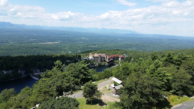
one last steep section the views become apparent. There are 2 fantastic lookouts before
arriving at a primitive campsite. There
is a Yellow Campsite marker leading to 2 fire pits and some areas for tent
setup. Through this campsite is a decent
westward view, the one and the only west view on this hike. Make camp or set out for the summit, which is
just a hair under 2 miles.
As
I said before, the trail will alternate between steep climbs and gentler
sections. While I believe the summit used to be marked, I could not find a
sign. There was a nice lookout from a
set of rocks, which were behind a fallen tree – the break occurring about waist
height. The morning sun shined brightly
through the clearing. I think this may
be the summit. My altimeter is pretty
accurate, and noted this spot as the highest point I had been at all day. My smartphone GPS was still functional while
on airplane mode; matching my location on the map put me damn close to the
summit (3,720’).
Continuing on the trail is another 2 viewpoints; the first
one could very well be the actual summit.
After reaching your final viewpoint you can turn around and retrace
those tough steps and relive the gorgeous views. The length between all the great spots isn’t
that bad, so planning meal stops and breaks is easy. Take your time or high tail it back to the
car! Make sure to sign out at the register
before completing your hike.


Comments
Post a Comment